حجم هذا العرض: 800 × 569 بكسل
الصورة بدقة كاملة (5,697 × 4,050 بكسل، حجم الملف: 7.84 ميجابايت، نوع الملف: image/jpeg)
 |
This map has been uploaded by Electionworld from en.wikipedia.org to enable the |
| This image (or other media file) is in the public domain because its copyright has expired. This applies to the United States, Canada, the European Union and those countries with a copyright term of life of the author plus 70 years.
| | | | | | | | | | | | | | | | | | | | | | | | | | | | | | | | | | | | | | | | | +/- |
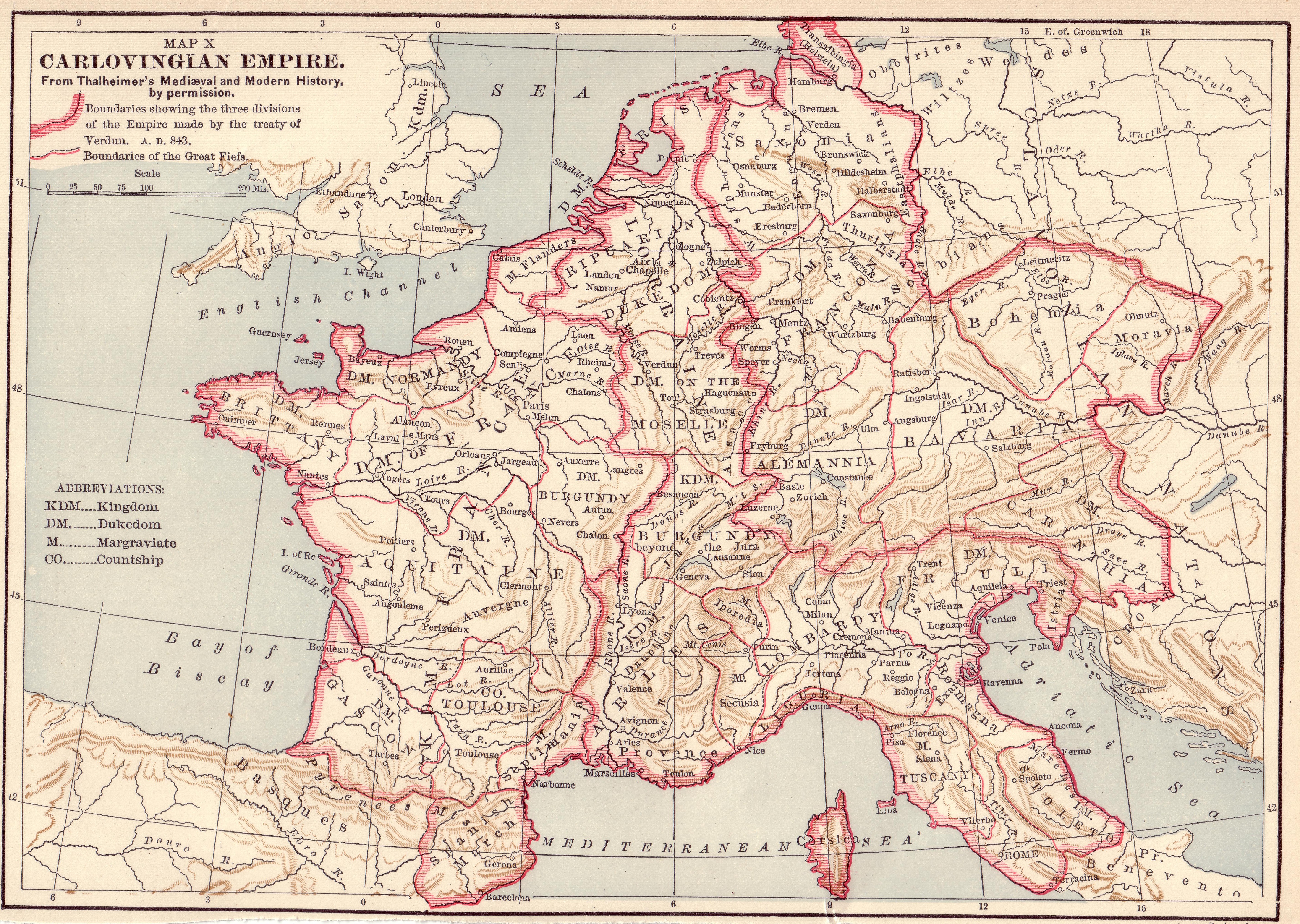
Source: Scanned by Stbalbach from Ridpath's Universal History, Copyright 1895, Section XII, Page 512.
وصلات
الصفحات التالية تحتوي على وصلة لهذه الصورة: