 حجم هذا العرض: 392 × 599 بكسلالصورة بدقة كاملة
 (530 × 810 بكسل، حجم الملف: 97 كيلوبايت، نوع الملف: image/png)
| Description |
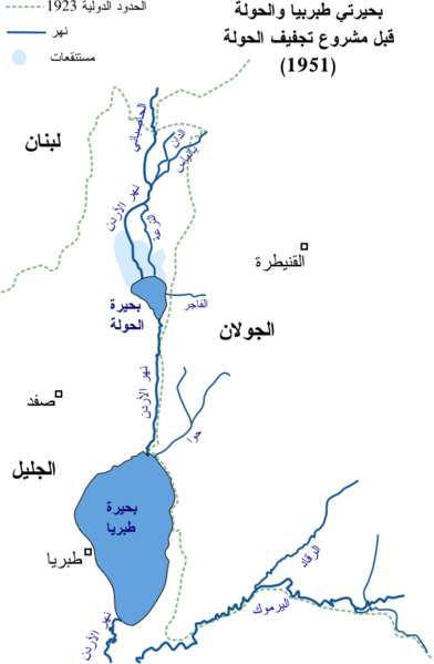
العربية: خارطة موارد المياه في شمالي شرقي الجليل قبل مشروع تجفيف الحولة في 1951
English: Arabic map of water sources NE part of the Galilee before 1951
|
| Source |
self-made
|
| Date |
|
| Author |
Drork
|
Permission
(Reusing this image) |
 |
I, the copyright holder of this work, hereby release it into the public domain. This applies worldwide.
In case this is not legally possible:
I grant anyone the right to use this work for any purpose, without any conditions, unless such conditions are required by law.
| | | | | | | | | | | | | | | | | | | | | | | | | | | | | | | | | | | | | | | | | | | | | | | | | | | | | | | | | | | +/-
|
|
 |
This map image should be recreated using vector graphics as an SVG file. This has several advantages; see Commons:Media for cleanup for more information. If an SVG form of this image is already available, please upload it. After uploading an SVG, replace this template with template {{|new image name.svg}} in this image. |
| | | | | | | | | | | | | | | | | | | | | | | Tiếng Việt | | | +/-
|
وصلات
الصفحات التالية تحتوي على وصلة لهذه الصورة:

