حجم هذا العرض: 800 × 398 بكسل
الصورة بدقة كاملة (1,265 × 629 بكسل، حجم الملف: 21 كيلوبايت، نوع الملف: image/gif)
Summary
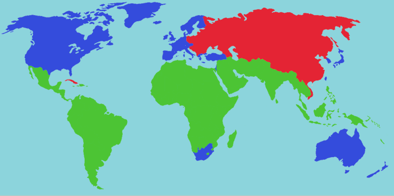
Shows traditional location of "First World", "Second World" and "Third World" countries during the Cold War:
- Blue: First World (Developed countries)
- Red: Second World (Current and/or former Communist countries. Not as common a used term; many of these countries are now considered first or third world)
- Green: Third World (Developing countries)
Licensing
|
 |
This map image should be recreated using vector graphics as an SVG file. This has several advantages; see Commons:Media for cleanup for more information. If an SVG form of this image is already available, please upload it. After uploading an SVG, replace this template with template {{|new image name.svg}} in this image. |
|
| | | | | | | | | | | | | | | | | | | | | | | Tiếng Việt | | | +/- |
|
See also
- Image:Cold War Map 1980.png (Geopolitics, Green countries splitted)
وصلات
الصفحات التالية تحتوي على وصلة لهذه الصورة:
