حجم هذا العرض: 359 × 598 بكسل
الصورة بدقة كاملة (2,199 × 3,666 بكسل، حجم الملف: 1.84 ميجابايت، نوع الملف: image/jpeg)
Sumario
| Description |
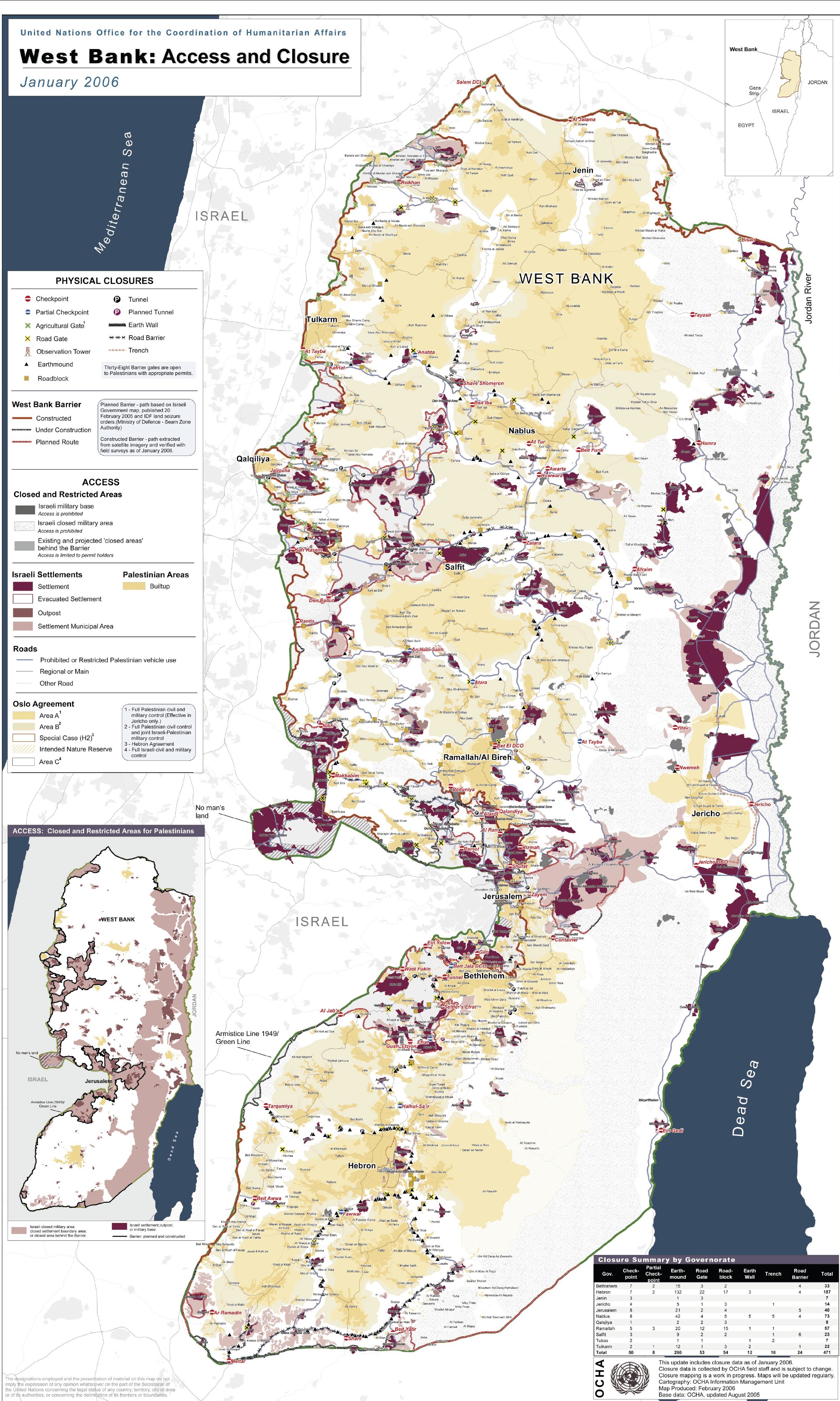
English: Detailed map of Israeli settlements on the West Bank, January 2006. Produced by the United Nations Office for the Coordination of Humanitarian Affairs - public UN source. Map Centre:
|
|---|---|
| Source |
United Nations |
| Date |
January 2006 |
| Author |
United Nations |
| Permission (Reusing this image) |
See below. |
Licensing
| This image is a mapping derived from products of the United Nations Cartographic Section. Modified versions of UNCS maps may be used provided that the UN name and reference number does not appear on any modified version and a link to the original map is provided. Modified UN maps are to be considered in the public domain. This applies worldwide The UN maps is an open source material. You can use them to make your own maps. You do not need our permission for that. Please be advised that the UN name and reference number should not appear on any modified map. The UN map is a UN document and cannot be modified. You can say something like "Based on UN map number..." -- Vladimir Bessarabov (UNCS Cartographer), 13 April 05 |
 |
وصلات
الصفحات التالية تحتوي على وصلة لهذه الصورة: