لا توجد دقة أعلى متوفرة.
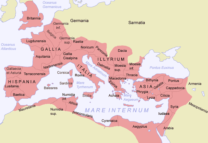
Roman_Empire_Map.png (800 × 548 بكسل، حجم الملف: 45 كيلوبايت، نوع الملف: image/png)
Creator: Jani Niemenmaa, 2004
Newer version available at image:Romia Imperio.png (copyright sign removed as requested; additionally, "Achaia" changed to "Achaea", Terraconensis to Tarraconensis (borders fixed), borders of Africa and Asia corrected). There is a second file Image:Romia Imperio sen provinconomoj.png without names of provinces, which is the basis for several locator maps of roman provinces.
 |
Permission is granted to copy, distribute and/or modify this document under the terms of the GNU Free Documentation license, Version 1.2 or any later version published by the Free Software Foundation; with no Invariant Sections, no Front-Cover Texts, and no Back-Cover Texts. A copy of the license is included in the section entitled "GNU Free Documentation license".
| | | | | | | | | | | | | | | | | | | | | | | | | | | | Ido | | | | | | | | | | | | | | | | | | | | | | | | | | | | | | | | | | | | +/- |
وصلات
الصفحات التالية تحتوي على وصلة لهذه الصورة: