حجم هذا العرض: 437 × 600 بكسل
الصورة بدقة كاملة (1,115 × 1,530 بكسل، حجم الملف: 106 كيلوبايت، نوع الملف: image/png)
Summary
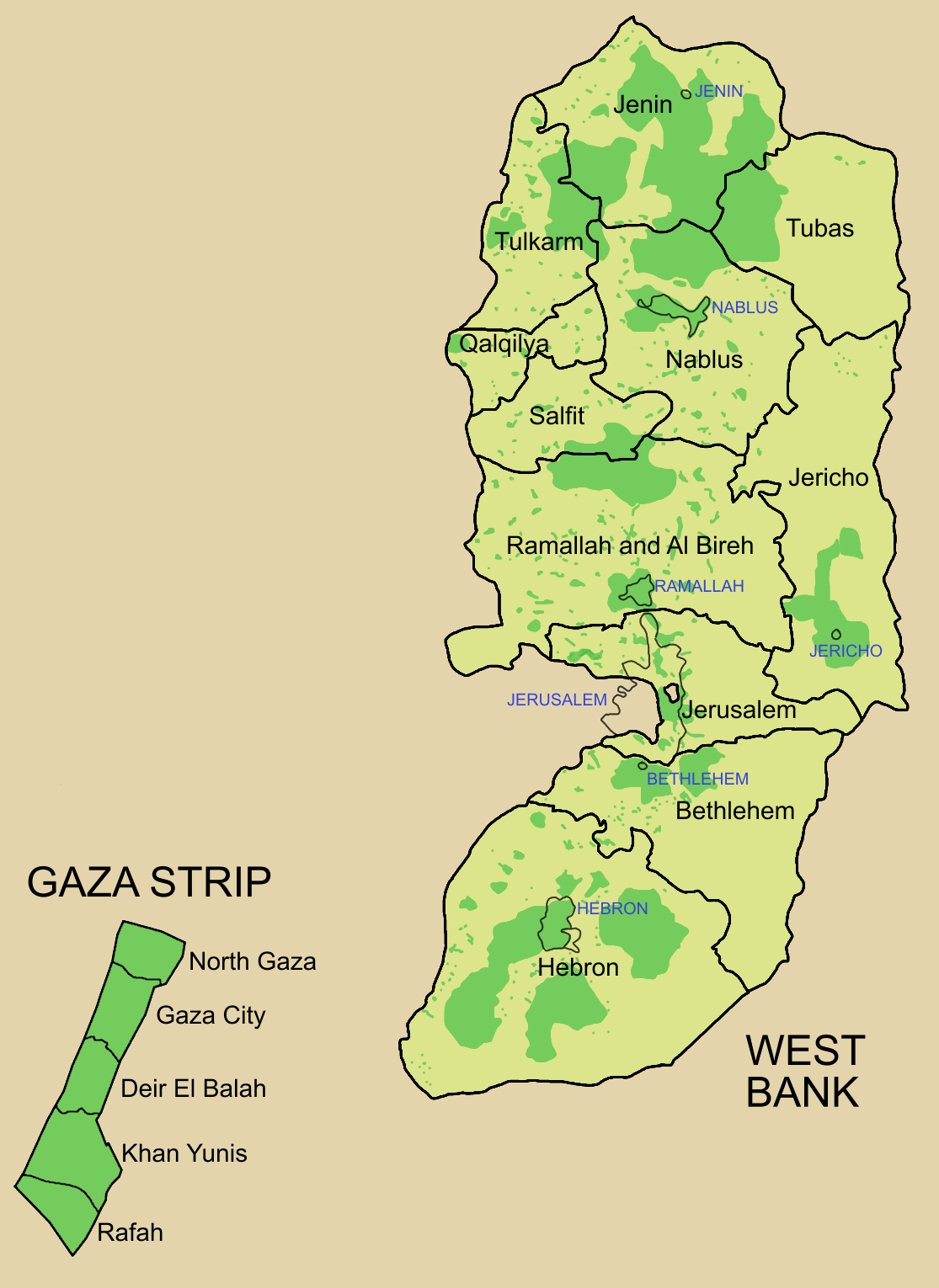
Palestine divided into electoral districts (as of 2006), marked with thick black borders. (thinner borders show boundaries of cities, with city names marked in blue). Green shows areas of formal Palestinian authority. Map made using information from other maps such as this. There is a map of the West Bank and Gaza governates from 1995 here
 |
This map image should be recreated using vector graphics as an SVG file. This has several advantages; see Commons:Media for cleanup for more information. If an SVG form of this image is already available, please upload it. After uploading an SVG, replace this template with template {{|new image name.svg}} in this image. |
|
| | | | | | | | | | | | | | | | | | | | | | | Tiếng Việt | | | +/- |
|
Licensing
 |
Permission is granted to copy, distribute and/or modify this document under the terms of the GNU Free Documentation license, Version 1.2 or any later version published by the Free Software Foundation; with no Invariant Sections, no Front-Cover Texts, and no Back-Cover Texts. A copy of the license is included in the section entitled "GNU Free Documentation license".
| | | | | | | | | | | | | | | | | | | | | | | | | | | | Ido | | | | | | | | | | | | | | | | | | | | | | | | | | | | | | | | | | | | +/- |
وصلات
الصفحات التالية تحتوي على وصلة لهذه الصورة: