حجم هذا العرض: 800 × 460 بكسل
الصورة بدقة كاملة (3,662 × 2,104 بكسل، حجم الملف: 557 كيلوبايت، نوع الملف: image/png)
| Description |
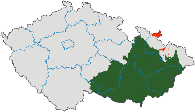
English: Moravia after 1920 on the map of the Czech Republic
|
|---|---|
| Source |
Originally from cs.wikipedia; description page is/was here. Made by modifying cs:Soubor:Česko-kraje.svg. |
| Date |
2006-05-21 (first version); 2006-11-24 (last version) |
| Author |
Original uploader was Kirk at cs.wikipedia |
| Permission (Reusing this image) |
Released under the GNU Free Documentation License; Licensed under the GFDL by the author. |
License information
|
Original upload log
(All user names refer to cs.wikipedia)
- 2006-11-24 22:31 Kirk 3662×2104×8 (570073 bytes) miniaturní korekce hranic
- 2006-11-21 19:17 Kirk 3662×2104×8 (570144 bytes)
- 2006-11-07 22:06 Kirk 3662×2104×8 (570097 bytes)
- 2006-11-04 07:40 Kirk 3662×2104×8 (570040 bytes)
- 2006-05-23 20:13 Kirk 800×460×8 (91061 bytes)
- 2006-05-22 16:02 Kirk 800×460×8 (91440 bytes)
- 2006-05-21 17:28 Kirk 800×460×8 (91501 bytes)
- 2006-05-21 16:32 Kirk 800×460×8 (91504 bytes)
- 2006-05-21 14:09 Kirk 800×460×8 (91496 bytes)
وصلات
الصفحات التالية تحتوي على وصلة لهذه الصورة:
