حجم هذا العرض: 464 × 599 بكسل
الصورة بدقة كاملة (824 × 1,064 بكسل، حجم الملف: 191 كيلوبايت، نوع الملف: image/jpeg)
| Description |
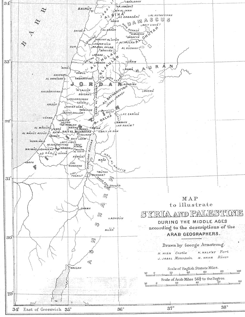
Map of Palestine during the Middle Ages according to the description of the Arab geographers, drawn by Geo. Armstrong, from Palestine Under the Muslims: A Description of Syria and the Holy Land from AD 650 to 1500, by Guy Le Strange, London 1890 |
|---|---|
| Source |
Originally from en.wikipedia; description page is/was here. |
| Date |
2004-11-16 (first version); 2005-09-21 (last version) |
| Author |
Original uploader was Mustafaa at en.wikipedia Later versions were uploaded by AnonMoos at en.wikipedia. |
| Permission (Reusing this image) |
This image is in the public domain due to its age. |
License information
| This image (or other media file) is in the public domain because its copyright has expired. This applies to the United States, Canada, the European Union and those countries with a copyright term of life of the author plus 70 years.
| | | | | | | | | | | | | | | | | | | | | | | | | | | | | | | | | | | | | | | | | +/- |
Original upload log
(All user names refer to en.wikipedia)
- 2005-09-21 17:41 AnonMoos 824×1064×8 (195077 bytes) Losslessly cropped image to area of interest
- 2004-11-16 21:36 Mustafaa 979×1072×8 (218293 bytes) Map of Palestine during the Middle Ages according to the description of the Arab geographers, drawn by Geo. Armstrong, from ''Palestine Under the Muslims: A Description of Syria and the Holy Land from AD 650 to 1500'', by Guy Le Strange, London 1890 (henc
وصلات
الصفحات التالية تحتوي على وصلة لهذه الصورة: