حجم هذا العرض: 800 × 550 بكسل
الصورة بدقة كاملة (1,985 × 1,365 بكسل، حجم الملف: 640 كيلوبايت، نوع الملف: image/png)
 |
This map image should be recreated using vector graphics as an SVG file. This has several advantages; see Commons:Media for cleanup for more information. If an SVG form of this image is already available, please upload it. After uploading an SVG, replace this template with template {{|new image name.svg}} in this image. |
|
| | | | | | | | | | | | | | | | | | | | | | | Tiếng Việt | | | +/- |
|
Summary
Português: Extenção do Império Assírio
Español: Extensión del Imperio Asirio
Polski: Mapa Asyrii
Dostępna też polska wersja pliku: Mapa Asyrii.png
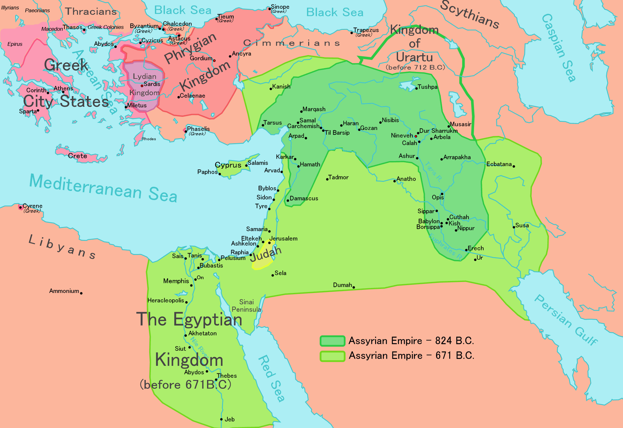
This is a large map of Assyria, made by Ningyou. Based on a map in 'Atlas of the Bible Lands', C S Hammond & Co (1959), ISBN 9780843709414.
For translations of this map, contact Ningyou.
Licensing
| I, the copyright holder of this work, hereby release it into the public domain. This applies worldwide. In case this is not legally possible: | | | | | | | | | | | | | | | | | | | | | | | | | | | | | | | | | | | | | | | | | | | | | | | | | | | | | | | | | | | +/- |
وصلات
الصفحات التالية تحتوي على وصلة لهذه الصورة: