حجم هذا العرض: 800 × 520 بكسل
الصورة بدقة كاملة (1,084 × 705 بكسل، حجم الملف: 29 كيلوبايت، نوع الملف: image/png)
| Description |
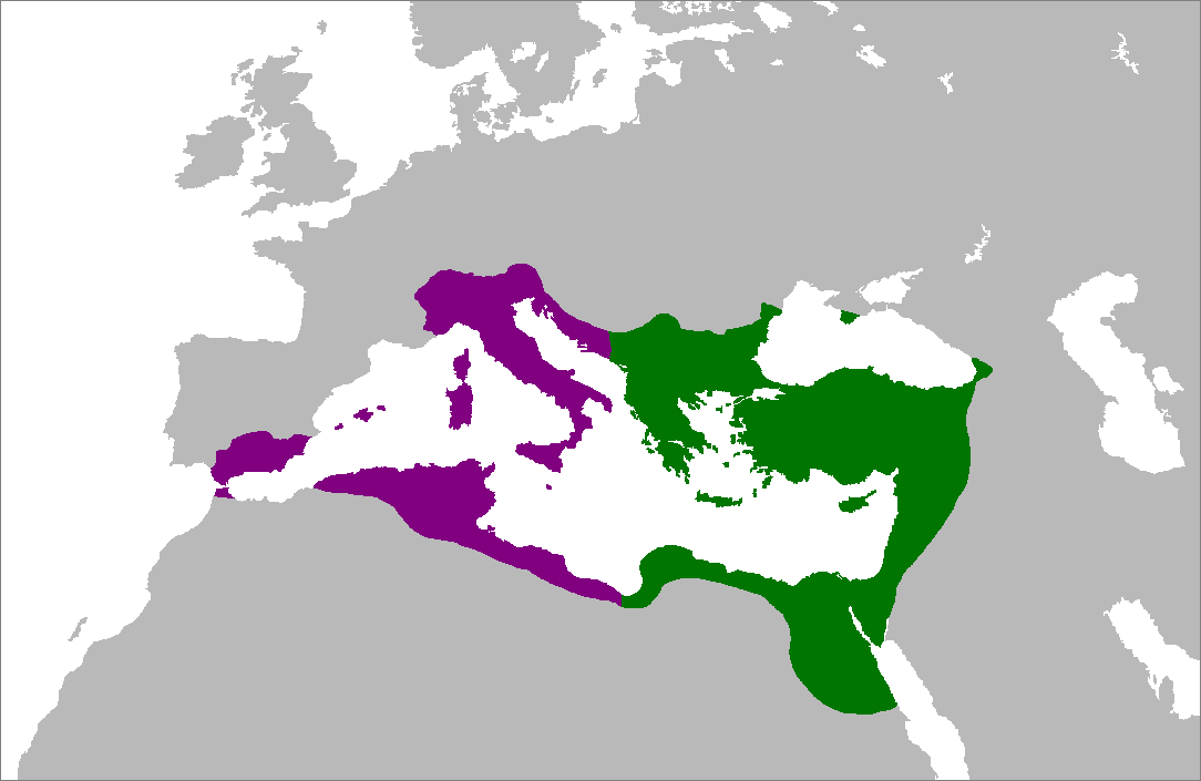
Map of the Byzantine Empire at its greatest extent in the 6th century. Territories in purple were reconquered during the reign of Justinian I. |
||
|---|---|---|---|
| Source |
Self-made from Image:LocationRomanEmpire.png; borders based on a map from http://www.bartleby.com/. |
||
| Date |
July 5, 2007 |
||
| Author |
Zakuragi |
||
| Permission (Reusing this image) |
|

 |
This Map image should be recreated using vector graphics as an SVG file. This has several advantages; see Commons:Media for cleanup for more information. If an SVG form of this image is already available, please upload it. After uploading an SVG, replace this template with template {{|new image name.svg}} in this image. |
|
| | | | | | | | | | | | | | | | | | | | | | | Tiếng Việt | | | +/- |
|
وصلات
الصفحات التالية تحتوي على وصلة لهذه الصورة: