حجم هذا العرض: 597 × 599 بكسل
الصورة بدقة كاملة (3,236 × 3,248 بكسل، حجم الملف: 1.59 ميجابايت، نوع الملف: image/png)
Beschreibung
| Description |
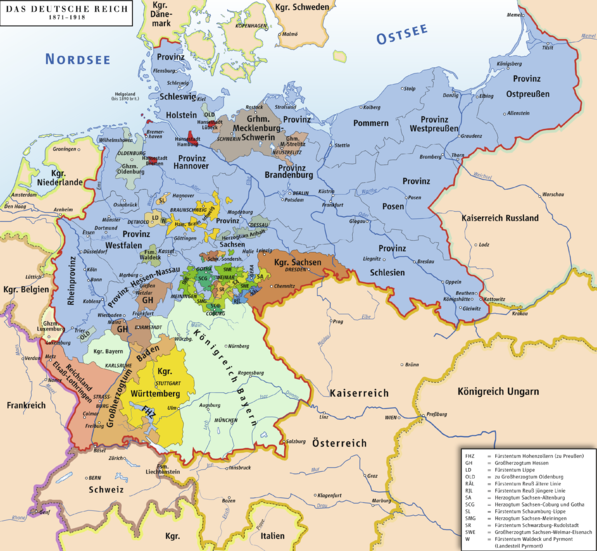
Karte des Deutschen Reiches 1871–1918 / Map of German Reich 1871–1918 |
|---|---|
| Source |
own drawing/Source of Information: Putzger – Historischer Weltatlas, 89. Auflage, 1965 |
| Date |
2006-09-21 |
| Author | |
| Permission (Reusing this image) |
GNU FDL |
| Other versions | unknown |
Licensing
|
|
A vector version of this image (SVG) is available. For more information about vector graphics, read about Commons transition to SVG. Български | | | | | | | | Bahasa Indonesia | | | | | | | | | 中文(简体) | 中文(繁體) | +/- |
 |
وصلات
الصفحات التالية تحتوي على وصلة لهذه الصورة:

