الرئيسيةبحث

صورة:CongoLualaba watershed topo.png


Summary

Description
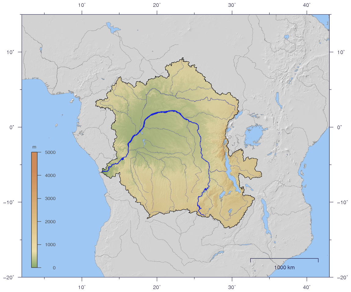
English: Course and Watershed of the Congo and Lualaba River with topography shading.
Deutsch: Verlauf und Einzugsgebiet von Kongo und Lualaba mit Reliefschattierung.
Source

The map has been created with the Generic Mapping Tools: http://gmt.soest.hawaii.edu/ using additional public comain data from the VMAP0 data set.

Date

2007-01-02

Author

Imagico

Permission
(Reusing this image)
Creative Commons License
Creative Commons Attribution iconCreative Commons Share Alike icon
This file is licensed under the Creative Commons Attribution ShareAlike 2.5 License. In short: you are free to share and make derivative works of the file under the conditions that you appropriately attribute it, and that you distribute it only under a license identical to this one. Official license
Other versions Image:CongoLualaba_watershed_plain.png

Licensing

I, the copyright holder of this work, hereby publish it under the following license:
Creative Commons License
Creative Commons Attribution iconCreative Commons Share Alike icon
This file is licensed under the Creative Commons Attribution ShareAlike 2.5 License. In short: you are free to share and make derivative works of the file under the conditions that you appropriately attribute it, and that you distribute it only under a license identical to this one. Official license

الصفحات التالية تحتوي على وصلة لهذه الصورة: