 حجم هذا العرض: 513 × 600 بكسلالصورة بدقة كاملة
 (944 × 1,104 بكسل، حجم الملف: 60 كيلوبايت، نوع الملف: image/png)
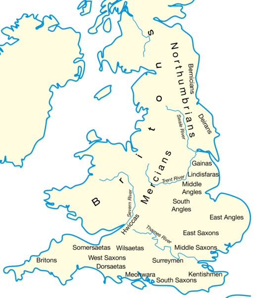
Drawn by User:IMeowbot; border data from CIA, people locations from The Historical Atlas by William R. Shepherd, 1926 edition, with clarifications supplied by en:User:Everyking per references used in en:Penda of Mercia.
Hmm, there's nothing very united about these kingdoms, feel free to reclassify if you've a better idea!
وصلات
الصفحات التالية تحتوي على وصلة لهذه الصورة:

