حجم هذا العرض: 800 × 553 بكسل
الصورة بدقة كاملة (1,299 × 898 بكسل، حجم الملف: 238 كيلوبايت، نوع الملف: image/jpeg)
Summary
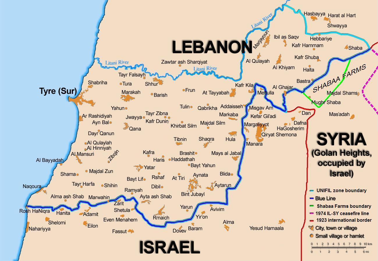
Map showing the Blue Line demarcation line between Lebanon and Israel, established by the UN after the Israeli withdrawal from southern Lebanon after its short 1978 invasion called "Operation Litani". It follows the 1949 cease-fire line, also known as the Green Line, as well as the somewhat contested Lebanese-Syrian border towards the Israeli-occupied Golan Heights. The map is made by Thomas Blomberg, using the UNIFIL map, deployment as of July 2006 as source.
Licensing
|
وصلات
الصفحات التالية تحتوي على وصلة لهذه الصورة: