حجم هذا العرض: 594 × 600 بكسل
الصورة بدقة كاملة (750 × 757 بكسل، حجم الملف: 81 كيلوبايت، نوع الملف: image/png)
 A vector version of this image (SVG) is available. For more information about vector graphics, read about Commons transition to SVG. Български | | | | | | | | Bahasa Indonesia | | | | | | | | | 中文(简体) | 中文(繁體) | +/- |
 |
Summary
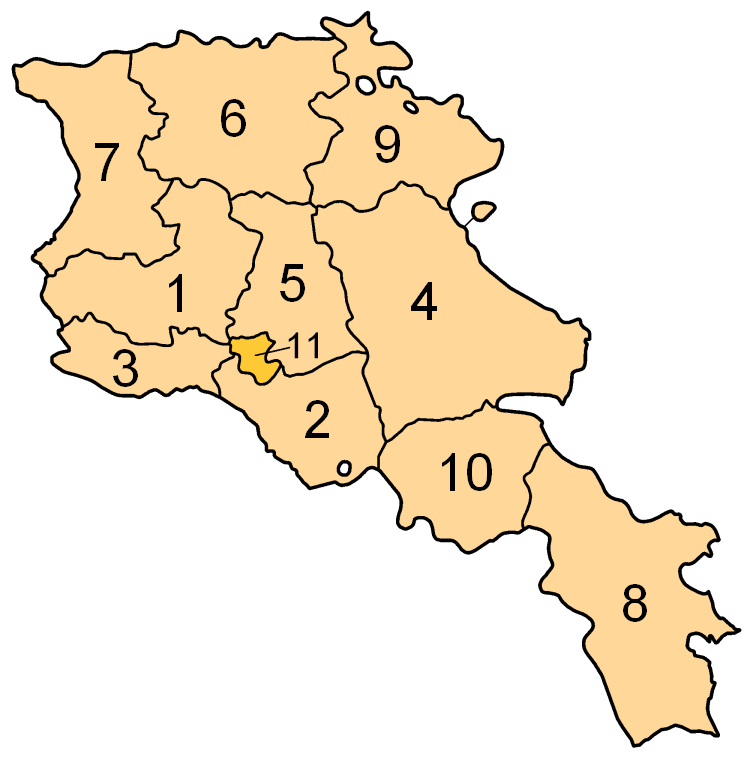
Subdivisions of Armenia. Map created by w:en:user:Golbez. Coloured by w:en:user:Aivazovsky.
Licensing
 |
Permission is granted to copy, distribute and/or modify this document under the terms of the GNU Free Documentation license, Version 1.2 or any later version published by the Free Software Foundation; with no Invariant Sections, no Front-Cover Texts, and no Back-Cover Texts. A copy of the license is included in the section entitled "GNU Free Documentation license".
| | | | | | | | | | | | | | | | | | | | | | | | | | | | Ido | | | | | | | | | | | | | | | | | | | | | | | | | | | | | | | | | | | | +/- |
Image shows the eleven administrative subdivisions of Armenia:
- Aragatsotn (Արագածոտնի)
- Ararat (Արարատի)
- Armavir (Արմավիրի)
- Gegharkunik (Գեղարքունիքի)
- Kotayk (Կոտայքի)
- Lori (Լոռու)
- Shirak (Շիրակի)
- Syunik (Սյունիքի)
- Tavush (Տավուշի)
- Vayots Dzor (Վայոց Ձորի)
- Yerevan (Երևան) - special administrative status
وصلات
الصفحات التالية تحتوي على وصلة لهذه الصورة: